Interior orders 1.25 million acre-foot Colorado River reduction
Federal operating rules establish two-year reservoir targets through 2036 while tribal water settlements face persistent infrastructure gaps across seven basin states.
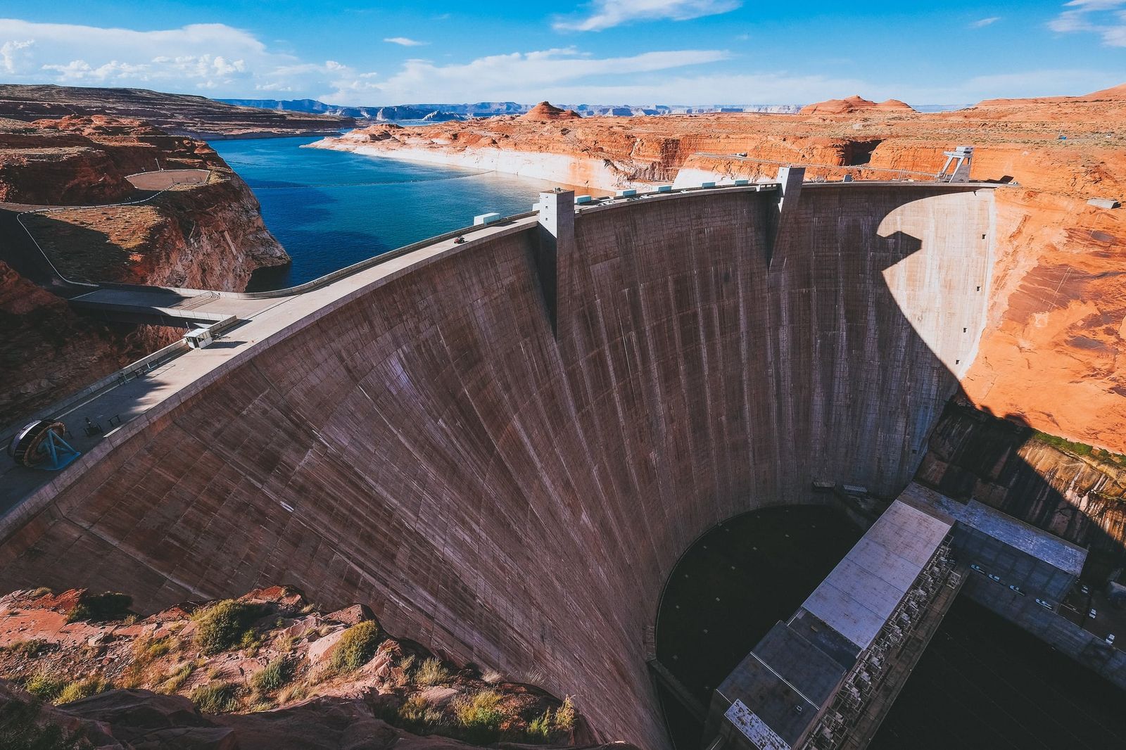
Federal water managers have established a regulatory framework for Lake Powell and Lake Mead that requires Arizona, California, and Nevada to cut water diversions by 1.25 million acre-feet annually over the next two years.12 The operating rules, which take effect on October 1, establish federal management criteria through 2036 while leaving long-term allocation disputes unresolved among the seven basin states.13 The decision follows a 26-year drought that dropped combined storage in the system's two primary reservoirs to the lowest levels recorded since Lake Powell began filling in 1963.31
A ten-year architecture of two-year operating reviews
The regulatory structure approved by the Department of the Interior marks an operational departure from the multi-decade compact agreements that historically governed western river management. After formal negotiations among the basin states failed to produce a consensus agreement for operations following the expiration of the 2007 interim guidelines, federal officials created a 10-year operating framework structured around recurring two-year reviews.34 The Bureau of Reclamation concluded an environmental impact review on July 31, leading to an official record of decision signed by Interior Secretary Doug Burgum on August 21.13
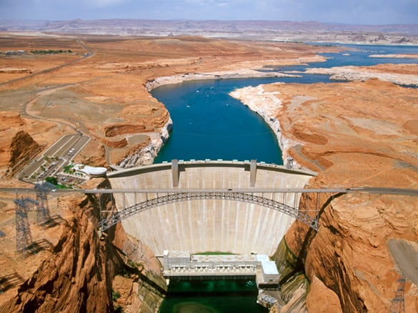
Under the administrative plan for 2027 and 2028, Reclamation officials will adjust release volumes passing through Glen Canyon Dam to maintain Lake Powell at or above 3,510 feet above sea level.12 Bureau engineers identify that elevation as critical to preserving the operational reliability of the dam's power generation and outlet tubes.15 Storage in both Lake Powell and Lake Mead reached record-low elevations in August 2026, prompting federal managers to mandate immediate demand reductions.3
The mandatory cuts fall primarily upon users in the Lower Basin states. If a pending tri-state allocation agreement is finalized, Arizona will absorb a reduction of 760,000 acre-feet each year, California will take 440,000 acre-feet, and Nevada will reduce deliveries by 50,000 acre-feet.12 The administrative decision also asks Lower Basin water users to voluntarily conserve and store an additional 700,000 acre-feet over the initial two-year period.12 By contrast, water users in Colorado, New Mexico, Utah, and Wyoming face no mandatory, fixed reductions under the initial rules.12
The Upper Basin rules instead outline mechanisms for coordinated operations across upstream storage facilities. Federal reservoir managers may adjust release rates from Flaming Gorge, Aspinall, and Navajo reservoirs in consultation with upstream states and sovereign tribes if additional volume is required to protect the structural integrity of Glen Canyon Dam.12 The operational division reflects legal boundaries codified a century ago, when the 1922 Colorado River Compact separated the drainage into Upper and Lower basins at Lee Ferry, Arizona.12
Paper allocations and physical delivery barriers
The federal decision exposes persistent disparities between legal water entitlements and operational delivery infrastructure across sovereign tribal reservations. The 1922 compact divided the river without tribal participation, establishing legal baselines that excluded thirty sovereign nations whose ancestral territories border the river and its tributaries.15 Over the ensuing century, tribes secured water rights through piecemeal litigation, federal court decrees, and negotiated congressional settlements, producing a patchwork of legal statuses that federal reservoir guidelines do not standardize.
The disparity between decreed rights and functional delivery systems defines water management across the Navajo Nation, whose 27,000-square-mile reservation spans parts of Arizona, New Mexico, and Utah.12 Crystal Tulley-Cordova, principal hydrologist with the Navajo Nation Department of Water Resources, observed that regional hydrology has shifted visibly while communities contend with systemic distribution shortfalls. Tulley-Cordova described an ongoing imbalance between paper water, which exists in legal statutes, and wet water, which reaches household taps.12
Hydrologic monitoring across the Navajo Nation reveals declining winter snowpacks, diminished springtime snowmelt, and disrupted summer monsoon cycles.12 The shifts have reduced streamflows in seasonal tributaries and altered vegetative growth across rangelands, including traditional plants such as green thread.12 Localized precipitation has concentrated into acute, intense downpours that cause soil erosion and infrastructure damage rather than sustaining aquifer recharge.
Federal operating guidelines do not accelerate the deployment of local municipal water pipelines. The Navajo-Gallup Water Supply Project, a major capital undertaking financed largely through Reclamation, remains under phased construction to transport water from the San Juan River to more than 250,000 residents across northwestern New Mexico and adjacent Navajo chapters.12 Tulley-Cordova explained that the post-2026 federal framework regulates reservoir gate operations, water retention, and dam discharge schedules, leaving the capital funding and physical construction of regional piping networks to independent programs.12
Legal boundaries also create administrative obstacles for tribal communities located near the dividing line between river basins. Under the proposed Northeastern Arizona Indian Water Rights Settlement Act of 2025, the Navajo Nation would receive an allocation of approximately 47,000 acre-feet from Upper Basin apportionments for communities located in Arizona.12 However, several communities requiring those supplies sit geographically south of the compact dividing line in the Lower Basin. Bidtah Becker, chief legal counsel for the Navajo Nation Office of the President and Vice President and a member of the Navajo Nation Water Rights Commission, noted that sovereign nations did not create the administrative lines that now complicate regional distributions.12
Infrastructure deficits along the upper tributaries
Similar physical bottlenecks restrict tribal water utilization in the Upper Basin states. The Ute Mountain Ute Tribe finalized its water rights settlement in Colorado decades ago, yet the tribe remains unable to divert its full legal apportionment due to missing conveyance canals and localized pumping facilities. Peter Ortego, president of Acadian Desert Consulting and former general counsel for the Ute Mountain Ute Tribe, pointed out that water stored in Lake Nighthorse near Durango must travel across state boundaries into New Mexico before reaching reservation lands.12
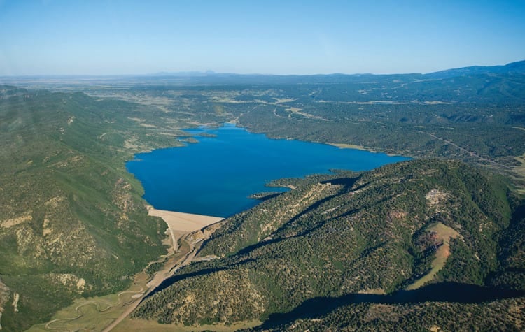
Because the necessary distribution network has never been built, approximately 16,000 acre-feet of the Ute Mountain Ute Tribe's settled allocation bypasses tribal land each year.12 The unused volume flows downstream into the larger Colorado River network, augmenting reservoir levels for downstream users without providing financial return or municipal supply to the tribal government that owns the right. Ortego argued that sovereign nations in this position should either receive direct federal funding to build diversion works or receive financial compensation for deferring their development during periods of regional scarcity.12
The administrative structure of the record of decision creates another layer of operational divergence through a federally controlled water pool. Reclamation officials established this reserve pool to fulfill federal delivery and firming commitments outlined in congressionally approved Indian water-rights settlements, to mitigate selected tribal shortages, and to protect federal dam facilities.12 However, the federal firming benefit applies only to a restricted group of Lower Basin tribal entities holding explicit federal firming covenants, including the Gila River Indian Community in central Arizona.12 The Navajo Nation and several other tribal governments are excluded from that firming mechanism.12
Senior decrees and expanding sovereign oversight
Tribes possessing senior, direct river diversions occupy a different legal footing under the federal guidelines. The Colorado River Indian Tribes, whose reservation encompasses extensive agricultural acreage along the main stem in Arizona and California, hold water rights dating to 1865.12 Those rights were quantified and confirmed through the 1963 Supreme Court decree in Arizona v. California, giving the tribal government the most senior priorities on the lower main stem.
During the federal environmental review, leaders of the Colorado River Indian Tribes challenged administrative draft proposals that suggested federal managers might apply across-the-board percentage reductions to all lower river contractors during deep storage deficits. Amelia Flores, chairwoman of the Colorado River Indian Tribes, stated that formal meetings between the tribal council and Reclamation officials resulted in federal commitments to respect the 1963 Supreme Court decree and exempt the tribe's senior allocations from mandatory operational cuts.12
The record of decision also formally incorporates tribal governments into basin-wide consultation mechanisms. While Celene Hawkins, Colorado River program director for The Nature Conservancy, observed that tribal nations historically lacked the direct administrative access enjoyed by state and federal negotiators, the new guidelines establish standing consultative protocols for the biennial operational reviews.12 Tribal officials emphasize that continuous participation is essential because subsequent two-year reviews could revise diversion rules if storage levels continue to decline.
Beyond statutory negotiations, sovereign nations are asserting legal doctrines rooted in traditional stewardship. The tribal council of the Colorado River Indian Tribes unanimously approved a resolution granting legal personhood status to the Colorado River, recognizing the waterway as an ecological entity whose survival is tied to human communities.1 As federal managers prepare to enforce the first round of delivery reductions on October 1, the stability of the Colorado River system rests upon reconciling paper compacts with physical hydrology across sovereign jurisdictions.
What this rests on
32 sentences trace to 5 sources.
-
1
R
RE:PUBLIC Document · republic.land "We Are Not a Monolith" See the source
-
2
H
hcn.org Third-party reporting · hcn.org · 28 Aug 2026 What the new rules for a shrinking Colorado River mean for tribal nations - High Country News See the source
-
3
U
usbr.gov Official record · usbr.gov Decision Documents | Bureau of Reclamation See the source
-
4
U
-
5
U