Tropical Storm Isaias strengthens toward first Atlantic hurricane of 2026
Federal forecasters issued storm surge and hurricane watches along the northern Gulf Coast as emergency declarations covered 25 Florida counties.
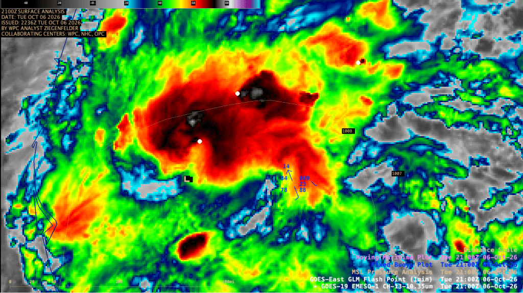
Tropical Storm Isaias organized over the warm waters of the southern Gulf of Mexico on Wednesday, putting the Atlantic basin on track for its first hurricane of the 2026 season.12 The system developed an expanded area of deep convection near and northeast of its center, prompting federal meteorologists to warn of life-threatening storm surge and damaging winds along the northern Gulf Coast by Friday.3
Data gathered by Air Force Hurricane Hunter aircraft during early reconnaissance flights indicated that the circulation center re-formed slightly north of earlier estimates.3 A dropsonde released into the storm registered an atmospheric pressure fall of 4 millibars, yielding an estimated central pressure of 1000 millibars.3 Initial maximum sustained surface winds were assessed at 40 knots, roughly 45 mph, as the storm charted an east-northeastward course at 7 knots.3
Federal forecasters noted that upper-level conditions favored rapid intensification over the central Gulf. Light to moderate vertical wind shear, near-record sea surface temperatures for early October, and abundant environmental moisture aligned to support steady organization.3 In an official forecast discussion, the National Hurricane Center stated that the low-level and mid-level centers were moving into better alignment, a structural change that often accelerates deepening in tropical systems.3
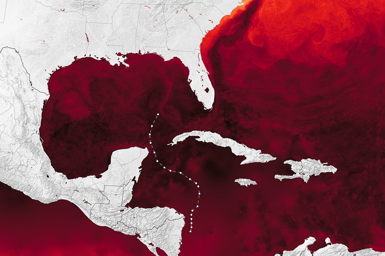
By early Thursday morning, the system intensified into a hurricane with maximum sustained winds of 75 mph and a central pressure falling to 981 millibars, according to public advisory records.4 The center of circulation moved east-northeast at 9 mph, located about 180 miles northwest of Progreso, Mexico, and roughly 445 miles south-southwest of the mouth of the Mississippi River.4 Multiple reconnaissance aircraft continued flying missions through the core to monitor wind fields and pressure trends.4
Watches extend across the northern coast
In response to the storm's trajectory, the National Hurricane Center issued a storm surge watch stretching from the mouth of the Mississippi River eastward to Yankeetown, Florida.3 Forecasters advised residents within the designated zone to monitor guidance from local emergency managers and prepare for mandatory evacuations if ordered.3 An accompanying hurricane watch covered coastal stretches from Bay St. Louis, Mississippi, to Indian Pass on the Florida Panhandle, where forecasters warned that prolonged power outages could follow damaging winds.3
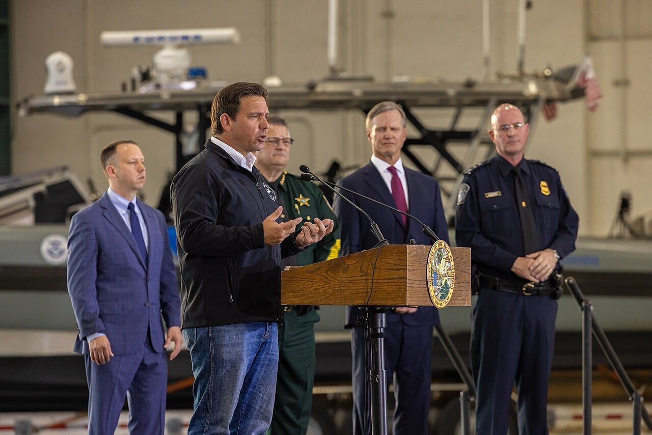
State authorities moved quickly to mobilize resources ahead of the system. Florida Gov. Ron DeSantis issued an executive order declaring a state of emergency across 25 counties, focusing emergency management assets on the Panhandle and Big Bend regions.2 DeSantis stated in a public bulletin that the order would ensure regional communities secure necessary supplies, urging residents to finalize household emergency kits and monitor state emergency management channels.2
Atmospheric steering patterns across North America are guiding the storm northward. An amplifying upper trough positioned along the northwestern Gulf Coast combined with a subtropical ridge building westward off Florida to accelerate the system toward land.3 Meteorologists cautioned that interaction with the trough would expand the physical size of the wind field, spreading hazards across a broader geographic footprint even if vertical shear induces modest weakening immediately prior to landfall.3
A delayed start to the Atlantic season
The emergence of the first hurricane in October marks an unusually sluggish start for the Atlantic basin. Forecasters with the National Oceanic and Atmospheric Administration had projected below-normal activity for the 2026 Atlantic season, largely driven by strong El Niño conditions in the equatorial Pacific that create disruptive atmospheric shear across the Caribbean and tropical Atlantic.42
While tropical activity remained subdued across the Atlantic through September, the eastern Pacific basin experienced active conditions.2 Even as Isaias organized in the Gulf, federal forecasters tracked two separate systems in the Pacific: Tropical Storm Simon, which packed sustained winds of 50 mph off the southwest coast of Mexico, and Hurricane Rachel, which maintained 75 mph winds farther west off Baja California.4
Isaias is projected to deliver heavy rainfall across the central Gulf Coast and widespread portions of the southeastern United States through the weekend.32 Federal forecasters warned that localized rainfall totals could trigger flash flooding, urban inundation, and isolated river crests as the storm crosses the coastline and tracks inland.3
What this rests on
23 sentences trace to 4 sources.
-
1
BK
Brian Kahn Document · wired.com · 7 Oct 2026 Tropical Storm Isaias Set to Be First Atlantic Hurricane of 2026 Season See the source
-
2
N6
NBC 6 South Florida Third-party reporting · nbcmiami.com · 7 Oct 2026 Tropical Storm Isaias forms; DeSantis declares state of emergency for 25 Florida counties See the source
-
3
N
nhc.noaa.gov Official record · nhc.noaa.gov https://www.nhc.noaa.gov/archive/2026/al09/al092026.discus.004.shtml See the source
-
4
N