Record central Pacific heat signals a shifting pattern for El Niño
Rising equatorial ocean temperatures threaten to disrupt global weather systems with severe floods and droughts, while prolonged warming in the central basin suggests future climate cycles may behave differently.
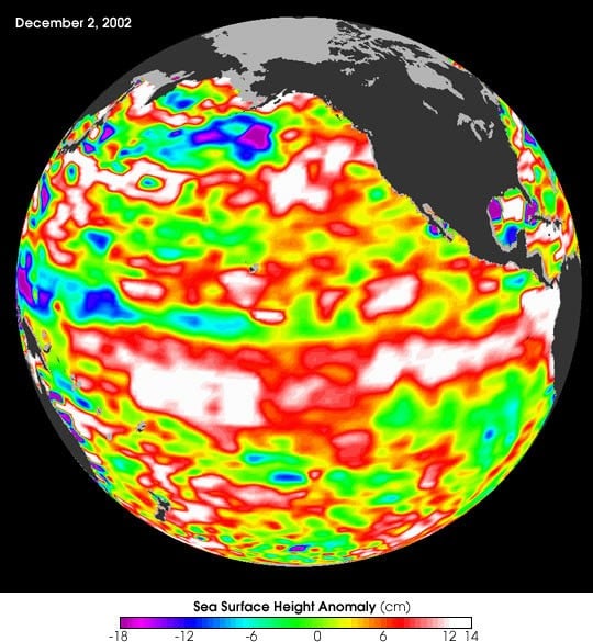
Across the equatorial Pacific Ocean, the exchange of heat between water and air governs rainfall patterns and storm tracks around the globe. Under typical conditions, steady westward trade winds drag sunlight-heated surface water toward Asia and Australia, leaving the central and eastern Pacific relatively cool as deeper water wells up from the ocean floor. When those winds slacken, that pool of warm water surges eastward, fundamentally altering the planetary heat engine.1 Warm surface water releases moisture and energy into the atmosphere, bending high-altitude winds and shifting rain-bearing weather systems away from their usual paths.1
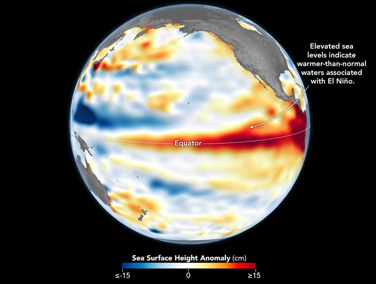
This recurring shift in oceanic warmth defines the warm phase of the climate system known as an El Niño event, and where that heat concentrates determines which continents face downpours or punishing droughts.1 The causal chain begins at the sea surface, where rising water temperatures warm the air immediately above the ocean, prompting it to rise and alter pressure fields that steer jet streams across the globe. Tracking where ocean water warms during an emerging cycle allows researchers to anticipate severe weather before storms develop.
Climatologists track these thermal shifts through observational monitoring networks across designated sectors of the tropical Pacific. According to preliminary observational data released on October 5, sea surface temperatures in a critical stretch of the central equatorial Pacific climbed beyond every recorded historical benchmark.1 Water temperatures in the central basin exceeded 86 degrees Fahrenheit, or 30 degrees Celsius, marking the first time that this sector has breached that boundary.1
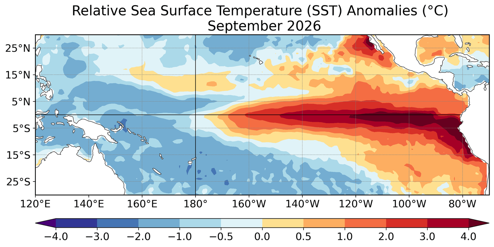
The unprecedented reading occurred within the Niño 3.4 region, a monitoring zone spanning between 5 degrees north and 5 degrees south latitude, and between 120 degrees west and 170 degrees west longitude.1 Climatologists rely on this marine corridor to measure the development and strength of El Niño events.1 At this time of year, surface temperatures exceeding 86 degrees Fahrenheit regularly occur in the western Pacific warm pool northeast of Australia, but the Niño 3.4 region typically remains considerably cooler.1 Jin-Yi Yu, a professor of Earth system science at the University of California, Irvine, described the measurements as an exceptionally warm state for this part of the tropical Pacific, noting that if verified in the consolidated observational dataset, it will represent an extraordinary record.1
Why does a warm patch in the central Pacific disrupt weather worldwide?
An El Niño event alters global weather because heat moving across the equatorial Pacific reshapes the atmospheric circulation that directs storms and rainfall around the planet.1 When warm surface water migrates eastward from the western tropical Pacific toward South America, it relocates atmospheric updrafts that fuel cloud formation and precipitation.1 Timothy Osborn, a professor of climate science and the director of the Climatic Research Unit at the University of East Anglia, explained that an event of record intensity disrupts atmospheric circulation controlling planetary weather patterns and rainfall distribution.1 The resulting shifts trigger severe rainfall and flooding across East Africa, southern China, the southern United States, and the Pacific coast of equatorial South America, while plunging Indonesia, the Philippines, southern Africa, and northern South America into drought.1
The intensity of those atmospheric disruptions depends directly on how far sea surface temperatures climb above historical averages. As of October 6, the temperature anomaly in the Niño 3.4 monitoring sector reached 6 degrees Fahrenheit, or 3.34 degrees Celsius, above the historical average for that date, and the anomaly continued to rise.1 A typical El Niño event elevates sea surface temperatures in the Niño 3.4 region by a maximum of 1.8 to 3.6 degrees Fahrenheit, or 1 to 2 degrees Celsius, above normal baselines.1 Because the observed warming so substantially exceeds that standard range, Yu described the current thermal anomaly as exceptionally large, stating that this deviation indicates that a very strong event, often called a super El Niño, is actively taking shape.1
How do climatologists determine the true strength of an El Niño?
Climatologists evaluate El Niño intensity by measuring ocean temperature anomalies relative to historical baselines rather than relying solely on absolute warmth.1 Absolute surface temperature alone is not the standard metric for determining event severity because background ocean warming can elevate absolute readings across the globe without driving the localized pressure contrasts that disrupt atmospheric circulation. Osborn pointed out that researchers normally gauge event strength by comparing regional temperatures in the Niño 3.4 sector against long-term averages for that specific tract of ocean, or by comparing them against surface temperatures across the rest of the global tropics.1 This comparative approach separates the localized dynamics of an El Niño from the broader heating of the oceans driven by human-induced climate change.1
When evaluated against those standardized relative metrics, the current warming cycle ranks among the most potent in modern history. Osborn stated that the current event is already close to being the strongest on record according to relative anomaly measures, adding that by certain metrics it is already record-breaking for this point in the seasonal cycle.1 Mat Collins, a professor of climate systems and the head of mathematics and statistics at the University of Exeter, also evaluated the temperature reading as very significant.1 Collins stated that background warming driven by human activity has elevated baseline ocean temperatures, making it probable that temperatures in the central Pacific will continue rising over coming weeks, peak in November or December, and decline in 2027.1 Yu agreed that the temperature anomaly will very likely remain extremely large, noting that atmospheric forecasters suggest the anomaly could reach 7.2 degrees Fahrenheit, or 4 degrees Celsius, by November.1
These preliminary figures represent daily sea surface observations that still require formal verification within consolidated historical climate records. An isolated daily reading above 30 degrees Celsius confirms an acute surge of regional warmth, but it cannot predict the exact timing of local storms or the precise severity of seasonal weather months in advance. The seasonal forecasts also depend on numerical climate simulations that model fluid atmosphere and ocean dynamics rather than direct measurements of future conditions. Furthermore, natural variability remains a powerful factor across multiyear ocean cycles, meaning that a record-setting surge in the central Pacific does not imply that every subsequent warming cycle will exceed the previous one.1
What does this temperature surge suggest about future climate patterns?
The unprecedented heat in the central Pacific suggests that global warming may be altering where future El Niño events concentrate their energy and how long they persist.1 While Collins observed that future events are likely to be more intense on average as the climate warms, Collins cautioned that individual events will remain variable, so not every occurrence will break records.1 Osborn likewise pointed out that extreme events will not automatically become a uniform baseline for every cycle.1 Instead, Osborn warned that the primary concern is the compounding of regional risks, where climate change primes vulnerable areas for extreme conditions before an El Niño even arrives.1 If an area drying from long-term warming coincides with a zone that suffers drought during an El Niño, severe water shortages can result, whereas naturally wetter areas facing El Niño downpours can experience worse flooding.1
The geographic pattern of the warming points to a structural shift in how tropical ocean cycles behave. Yu explained that research conducted by his group and collaborators documented changes not only in the overall intensity of El Niño events, but also in where ocean warming concentrates and how long individual episodes endure.1 Yu and his colleagues helped introduce the concept that two distinct varieties of the phenomenon exist, dividing events into eastern Pacific and central Pacific types.1 Historically, events developed primarily through warming in the eastern tropical Pacific near the South American coast.1 In recent decades, events centered in the central Pacific have become considerably more prominent, and these episodes have demonstrated a tendency to persist for longer periods.1
This changing spatial pattern appears linked to how global warming alters broader atmospheric interactions. Yu explained that human-driven warming may be generating a distinct mode of El Niño by intensifying interactions between the atmosphere and the ocean across the subtropical Pacific.1 If those subtropical processes interact with equatorial dynamics where eastern Pacific events traditionally originate, they can generate exceptionally strong events marked by extreme warming directly in the central Pacific basin.1 Yu noted that this physical interaction provides a compelling scientific mechanism for why extreme events could occur more frequently in a warmer climate, while pointing out that this mechanism does not mean every future event will grow progressively stronger.1
What this rests on
36 sentences trace to 1 source.
-
1
SP
Sascha Pare Document · livescience.com · 8 Oct 2026 The central Pacific Ocean just broke a temperature record. Experts say it might signal a new kind of El Niño. See the source