Ancient shorelines show Earth tipped on its spin axis
Shifting global ocean levels over 320 million years reveal four episodes where the solid planet slid beneath its climate belts, reshaping ancient coasts and habitats.
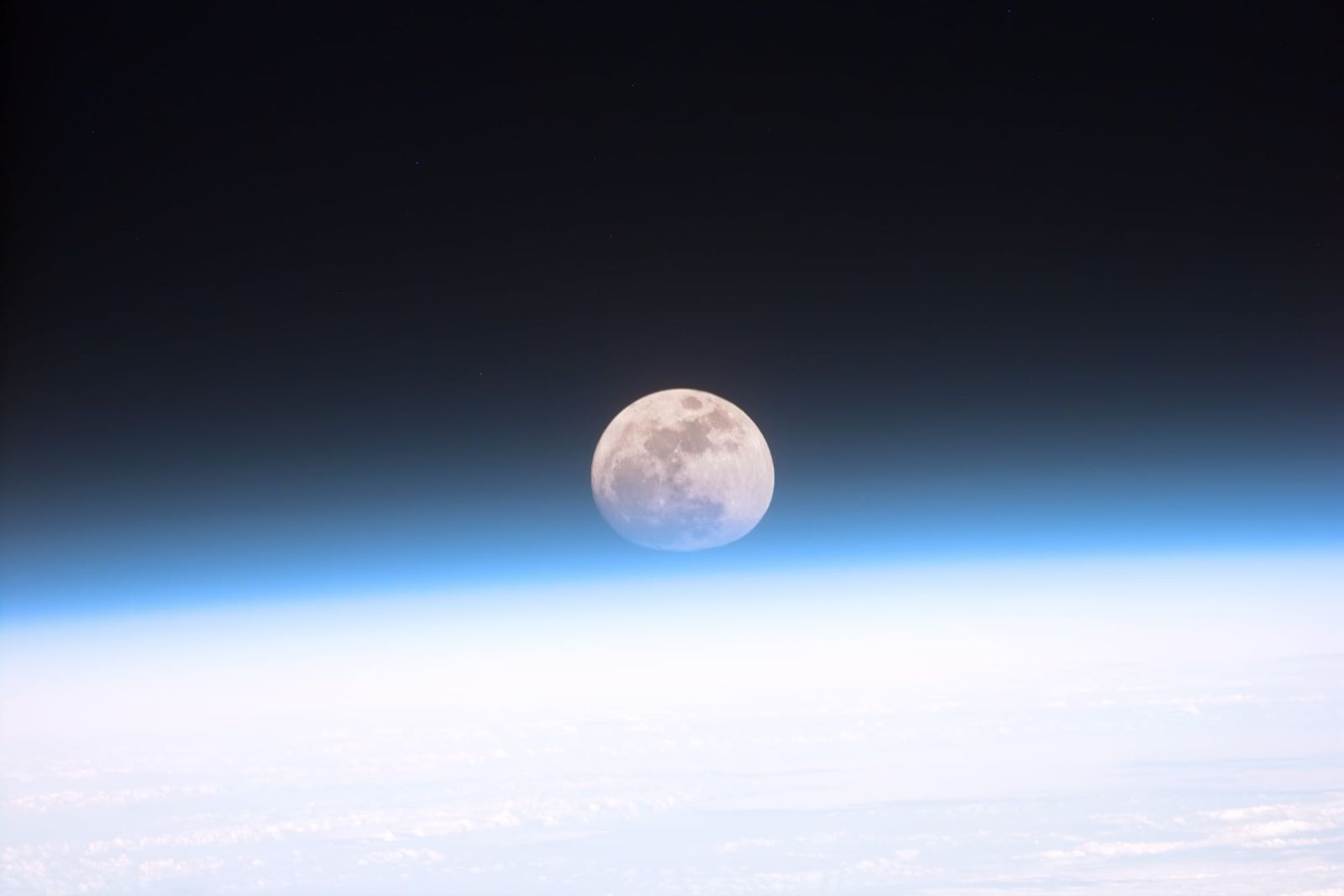
When geologists look back through hundreds of millions of years of rock history, they typically assume that landmasses moved while the geographic poles remained essentially steady. Tectonic plates drift across the surface, carrying continents from equatorial warmth to polar chill over vast expanses of geological time. Yet every so often, the solid crust and viscous mantle beneath it appear to have slipped as a collective unit, rolling across the deeper interior while the planet continued to spin in space.
This sweeping realignment is known as true polar wander, a phenomenon in which the geographic poles migrate across Earth's surface because the solid planet tips to rebalance its own uneven distribution of weight.123 While the core beneath and the solar climate belts above stay anchored to the rotational axis, whole continents can slide into new latitudes in a geologically short window.14 For decades, researchers debated whether such tipping events ever occurred rapidly enough to matter, or whether the planet's orientation remained largely stable across deep time.14
A study published on October 1, 2026, in the journal Science now demonstrates that the oceans preserved an unmistakable record of these planetary shifts.43 Mathew Domeier, a geophysicist at the Centre for Planetary Habitability at the University of Oslo in Norway, led an investigation that tracked ancient sea levels across 320 million years.13 By analysing the geographic footprints of marine inundation, Domeier and colleagues confirmed that Earth experienced four separate intervals of rapid polar wander, reshaping shorelines across the globe during the age of the dinosaurs and beyond.12
How does a spinning planet tip its solid shell?
Earth reorients its outer layers whenever interior churn or drifting plates shift enough mass away from balance. The planet is not a rigid or perfectly symmetrical sphere; its rapid daily spin bulges rock and water outward at the equator, creating a slightly squashed shape.123 Beneath the rigid surface crust lies the semi-fluid mantle, which flows under intense heat and pressure over millions of years.32
When deep mantle convection plumes rise or heavy tectonic slabs sink into the depths, that internal motion redistributes enormous quantities of mass.14 A spinning object naturally seeks to keep its heaviest concentrations of matter along its rotational equator, where centrifugal forces are greatest. If mass gathers elsewhere, the entire solid Earth slowly adjusts to restore that dynamic equilibrium, sliding the crust and mantle over the liquid outer core while the spin axis points in the same celestial direction.23
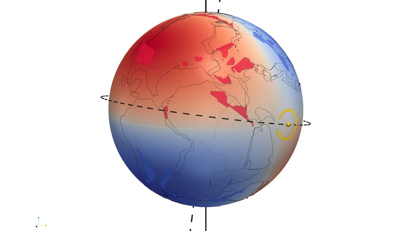
Before any numeric measurements can make sense, the physical consequence for the oceans must be understood. The ocean surface is fluid and responds almost immediately to gravity and planetary spin, maintaining a persistent bulge along the rotational equator.13 By contrast, the rocky crust and viscous mantle deform far more sluggishly.2 When the rocky sphere rolls beneath the spin axis, the stationary equatorial bulge of seawater washes over landmasses rotating toward the equator, while continents swinging toward the poles emerge from the sea as the water recedes.13
Why do moving shorelines leave a four-lobed pattern?
A tilting planet creates a distinctive quadrupolar pattern of sea-level rise and fall that cannot be produced by melting ice or sinking basins.1 As the solid globe pivots around an internal hinge, two opposite quadrants of the planet experience a relative rise in sea level, while the alternating two quadrants see sea levels plunge.123 This geometry distributes flooding and exposure across four alternating lobes, producing a four-leaf clover shape across global maps.13
Ordinary causes of sea-level fluctuation behave very differently. When polar ice sheets melt, water spreads across the oceans, causing a global sea-level rise that affects coastlines everywhere in a relatively uniform way.1 Similarly, when a regional basin subsides or a mountain chain rises, the resulting marine shifts remain local.1 Mathew Domeier and colleagues realized that only a rapid rotational reorientation could cause simultaneous marine flooding in two opposing sectors of the planet while exposing dry land in the two intervening sectors.13
To capture that specific signature, Domeier and his collaborators compiled continental flooding maps spanning the past 320 million years at 10-million-year intervals.1 Geologists reconstruct these ancient shorelines from the sedimentary rock record, recognizing ancient floods from marine sediments preserved on dry land and identifying dry spells from erosion surfaces and missing strata.1 Applying statistical modeling to these sequential maps, the authors searched for the telltale quadrupolar redistribution of ocean water across geological stages.14
When did Earth undergo these rapid planetary shifts?
Four distinct geological intervals over the past 320 million years display the statistical signature of rapid true polar wander.123 The earliest event identified in the dataset took place during the Early Jurassic, roughly 200 to 190 million years ago.23 A second major shift occurred between the Late Jurassic and the Early Cretaceous, approximately 150 to 140 million years ago.124 A third episode took place in the mid-Cretaceous, roughly 100 to 90 million years ago, and the most recent episode occurred during the Oligocene to Miocene epochs, about 30 to 20 million years ago.13

The findings provide crucial independent verification for earlier paleomagnetic studies, which measure fossil magnetic alignments preserved in ancient rocks.14 Paleomagnetism can establish what latitude a rock formed at by recording the tilt of Earth's magnetic field lines, but distinguishing whether a continent drifted northward on its own or rolled as part of a global planetary reorientation has long triggered fierce debate.13 By showing that the hydrosphere preserved matching shifts, the research refutes the longstanding view that true polar wander was negligible or persistently slow across deep time.14
Equally notable was what the sea-level maps did not show. Through most of the Cenozoic era, the period that began 66 million years ago following the extinction of the non-avian dinosaurs, the researchers detected little evidence of rapid polar wander.14 Furthermore, the analysis found no significant signal supporting the hypothesis that true polar wander was the primary driver of the rapid northward transit of the supercontinent Pangea during the late Carboniferous and Permian periods.14
What are the limits of ancient sea-level data?
Statistical models of ancient flooding patterns describe broad planetary movements rather than exact day-to-day rotational speeds or total angular distances.13 The rock record is inherently incomplete, preserving sedimentary snapshots across 10-million-year intervals that smooth over brief, localized transgressions.12 While the quadrupolar signal is mathematically distinctive, the published analysis does not quantify the exact degrees of rotational tilt or the absolute physical velocity of the crust during each event.13
The study also assumes that continental reconstructions and sedimentary compilations over the past 320 million years have sufficient global coverage to isolate rotational signals from plate tectonic drift.1 In regions where sedimentary rocks have eroded away or remain unmapped, regional sea-level histories must be inferred. The authors note that while the mid-Cretaceous and Jurassic episodes align neatly with paleomagnetic models, further scrutiny is warranted to refine the precise mechanisms that triggered each burst of mantle imbalance.2
A clearer picture of true polar wander nevertheless carries broad implications for Earth system science. Moving whole continents across latitude lines changes solar exposure, alters oceanic circulation pathways, and transforms regional weather systems without requiring conventional tectonic drift.13 Shallow epicontinental seas, which foster diverse marine ecosystems, would expand or vanish in response, driving environmental turnover.13 Geoscientists must now work to identify the specific deep-mantle mass movements that initiated each reorientation, testing whether catastrophic thermal upwellings or descending oceanic slabs set the planet rocking.
The record
38 sentences trace to 4 sources.
-
1
S
scientificinquirer Document · scientificinquirer.com · 26 Oct 2026 Ancient Sea Levels Record Four Episodes When Earth Shifted Relative to Its Spin Axis See the source
-
2
G
gizmodo.com Third-party reporting · gizmodo.com · 1 Oct 2026 Earth Tipped on Its Side During the Age of Dinosaurs—and Not Just Once See the source
-
3
SM
Smithsonian Magazine Third-party reporting · smithsonianmag.com · 19 Oct 2026 Earth's True North and South Poles Have Wandered Four Times Over the Past 320 Million Years, Study Suggests See the source
-
4
E
eurekalert.org Third-party reporting · eurekalert.org Ancient seas reveal times when the Earth rapidly shifted relative to its axis See the source