Ocean models turn coarse sea surface maps into fine coastal detail
Simulating narrow coastal seas without supercomputers requires understanding how heat, salt, and swirling currents lock together across shifting seasons.
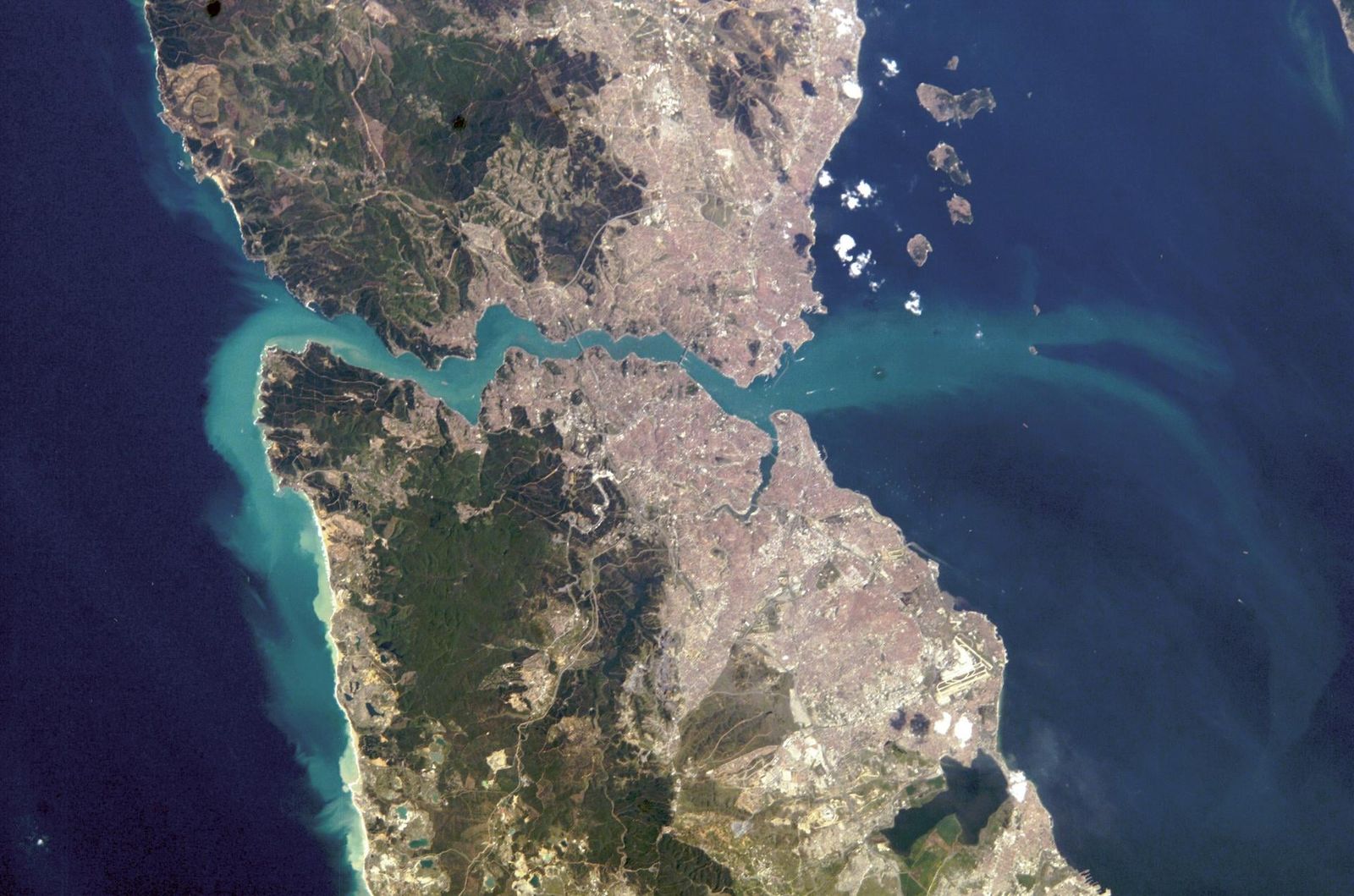
Surface waters in narrow coastal basins do not move in broad, uniform sheets. Instead, they twist through narrow channels, curl into short-lived swirling eddies, and change rapidly across distances of only a few kilometers. Measuring or simulating these localized shifts at fine scale has long posed an operational dilemma for oceanographers. Satellite sensors pass overhead too infrequently or at spatial resolutions too blunt to record every transient whorl. At the same time, physical numerical simulations fine enough to capture them demand immense supercomputing power that cannot run continuously across every coastline on Earth.
When marine researchers simulate large bodies of water, they often must choose between running a coarse model over a wide geographic area or concentrating their computing budget on a tiny pocket of coastline. That compromise leaves significant blind spots. Coastlines concentrate human maritime activity, commercial fishing, port operations, and fragile shallow-water ecosystems, all of which depend heavily on knowing exact water temperatures, salt levels, and current speeds. Missing a coastal eddy can mean misjudging where an oil spill drifts, where fish larvae disperse, or how rapidly heat enters a shallow bay.
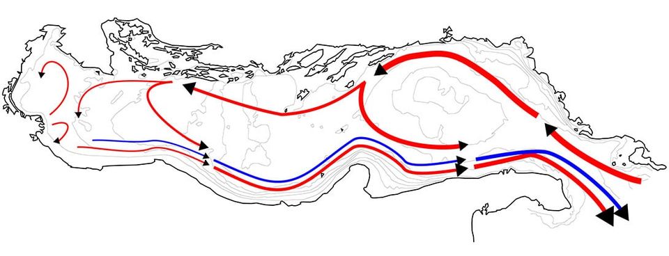
Fine-scale water movements emerge from the physical momentum and thermodynamics of broader ocean basins. In an enclosed basin such as the Adriatic Sea, large-scale winds and major basin-wide currents push water against steep coastlines and shallow shelf areas. This movement sets off secondary motions, breaking large parcels of water down into smaller, tighter vortices that alter regional salinity and sea surface temperature. Because these fine features obey consistent seasonal patterns and physical laws dictated by the larger flow, the relationship between broad patterns and local eddies leaves a mathematical footprint across historical records.
How can computers reconstruct missing ocean details?
Computers can recover fine ocean details by learning how large-scale water patterns guide smaller, localized motions over time. In a physical basin, water properties do not exist in isolation. Large currents transport warm or salty water across hundreds of kilometers, while local variations in heat and salt determine the density of seawater, which in turn sets secondary currents in motion. Where two distinct water masses meet along a marine front, a sudden shift in temperature coincides with a sharp contrast in salinity and a narrow jet of current flowing between them.
Statistical models trained on historical ocean records can study these interlocking connections. By comparing blurred, wide-area maps with fine-scale simulations of the same days, a network learns how broad heat and salt distributions shape small coastal features. Once trained on these historical pairings, the system can examine a new, low-resolution ocean map and synthesize the probable fine structures that a high-resolution simulation would have computed.
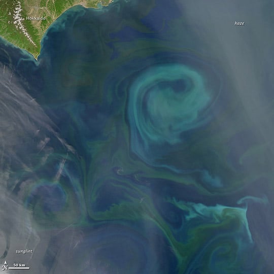
Applying this strategy to marine data, researchers Rajat Srivastava, Muhammad Sarmad, Emanuele Mele, Massimo Cafaro, Marco Pulimeno, and Italo Epicoco developed OcDiffSR, a conditional denoising diffusion probabilistic model designed for oceanographic super-resolution.1 A diffusion model works by learning to gradually remove synthetic noise from an input until it recovers a clean, coherent data field matching physical conditions. According to a preprint posted on the arXiv server, the model reconstructs high-resolution sea-surface fields from coarse-resolution reanalysis inputs, generating detailed maps of sea surface temperature, sea surface salinity, and horizontal current velocities simultaneously.1
Developing an engine that sharpens multiple marine variables at once helps align features that would otherwise clash. As co-author Italo told Primary, currents, heat, and salt operate as an interconnected physical system. "In the sea, temperature, salinity and currents are not independent," Italo said, explaining that a system reconstructing fields individually must discover dynamic boundaries several times over. "A model that sharpens one variable at a time has to rediscover that front separately in each map, and the results may not line up," Italo said, adding that generating the maps jointly allows a gradient in salinity to help position a sharp velocity jet.
What did the Adriatic Sea evaluations reveal?
Evaluations across a full calendar year showed that the unified model reconstructed delicate coastal structures with low statistical error. The authors trained the model on 10 years of paired historical data spanning 2011 to 2020 over the Adriatic Sea, drawing coarse inputs at one-twelfth of a degree resolution from the GLORYS12V1 dataset and fine target fields at one-twenty-fourth of a degree resolution from the Mediterranean Sea Physics Reanalysis Med MFC dataset.1 They then tested its performance against an independent test year, 2009, measuring how closely its synthesized surfaces matched known physical conditions.1
Selecting 2009 provided a strict test of whether the system had memorized patterns or grasped true physical dynamics. As Italo explained to Primary, choosing a year outside the 2011 to 2020 window prevented data leakage between consecutive days, while confronting the model with unusual anomalies. Satellite measurements confirmed that the Adriatic surface in 2009 was about 0.7 degrees Celsius cooler on average than the 2011 to 2020 training baseline, cooler than any single training year, and dominated by an inflow of fresher water from the northern Ionian Sea. The test year also experienced major river flooding from the Po river in early May alongside an intense late-spring marine heatwave.
Testing on that independent test year showed strong accuracy for scalar measurements, which represent physical quantities that have magnitude without direction. For sea surface temperature, the authors recorded a root mean square error of 0.477 degrees Celsius compared with high-resolution reference data.1 For sea surface salinity, the model achieved a root mean square error of 0.346 practical salinity units against the reference dataset.1 The reconstructed scalar fields achieved a Pearson correlation coefficient equal to or exceeding 0.999 relative to reference fields, alongside a structural similarity index measure equal to or exceeding 0.964.1
The authors reported that the system outperformed standard bilinear interpolation and the residual diffusion model CorrDiff in absolute error and spatial coherence.1 On the 2009 test set, CorrDiff produced a root mean square error of 0.81 degrees Celsius for sea surface temperature and 0.88 practical salinity units for salinity, meaning the new model reduced temperature error by about 40 percent and salinity error by about 60 percent relative to the alternative diffusion baseline.
Dynamic vector fields, which track horizontal water velocity components that possess both speed and direction, proved more challenging to reconstruct. The model achieved a Pearson correlation coefficient of 0.64 for velocity fields relative to reference data, a moderate figure that the authors attributed to the intrinsic stochasticity of oceanic velocity fields.1 Italo noted that errors in current vectors typically stemmed from tiny spatial misalignments of only a few kilometers during the late spring transition, where an eddy was placed slightly off its true position.
What are the limits of the current findings?
These findings demonstrate a computational model evaluated on historical reanalysis products rather than real-time operational sensors at sea. The preprint posted by Srivastava and colleagues has not yet undergone peer review. Furthermore, the model was trained and evaluated specifically within the geographic boundaries of the Adriatic Sea, an enclosed basin with distinct land boundaries and circulation systems.1 A system trained on the Adriatic cannot automatically translate to open oceanic basins or regions with different tidal regimes without retraining on local paired datasets. The team also observed a minor cold bias along a narrow coastal fringe, which Italo attributed to land-masking procedures during data preparation rather than physical dynamics.
The moderate correlation score of 0.64 for current velocities also shows that while the model captures the overall layout and visual coherence of water currents, it cannot predict every individual turbulent vector with the certainty it achieves for temperature and salinity.1 The model relies on the assumption that underlying coarse reanalysis products provide an accurate depiction of broad basin dynamics. If an underlying coarse dataset contains systemic observational errors, the diffusion model will propagate those inaccuracies into its synthesized fine-scale outputs.
If validated across further ocean basins and real-time operational streams, diffusion-based super-resolution could reduce the supercomputing power required to monitor sensitive coastal environments. Marine agencies could run modest, coarse global circulation models and use automated downscaling to generate sharp coastal forecasts on demand. For coastal researchers and mariners, the approach offers a practical way to fill the resolution gap between satellite sweeps without waiting days for high-resolution physics simulations to finish computing.
The record
15 sentences trace to 1 source and 1 contributor.
-
1
RS
Rajat Srivastava, Muhammad Sarmad, Emanuele Mele, Massimo Cafaro, Marco Pulimeno, Italo Epicoco Paper · arxiv.org · 22 Sep 2026 Diffusion-Based Super-Resolution of Adriatic Sea Oceanographic Fields Preprint · may not have been peer reviewed See the source
- 2 Contribution — Italo Epicoco 12 statements added to this article
Article history
-
Published 27 Oct 2026, 17:39Assembled by the Primary desk from 1 source · 1 contributor · 15 cited sentences
-
Italo Epicoco
- Go to the sentence: According to a preprint posted on the arXiv server, the model reconstructs high-resolution sea-surface fields from coarse-resolution reanalysis inputs, generating detailed maps of sea surface temperature, sea surface salinity, and horizontal current velocities simultaneously.
- Go to the sentence: "In the sea, temperature, salinity and currents are not independent," Italo said, explaining that a system reconstructing fields individually must discover dynamic boundaries several times over.
- Go to the sentence: "A model that sharpens one variable at a time has to rediscover that front separately in each map, and the results may not line up," Italo said, adding that generating the maps jointly allows a gradient in salinity to help position a sharp velocity jet.
- Go to the sentence: They then tested its performance against an independent test year, 2009, measuring how closely its synthesized surfaces matched known physical conditions.
- Go to the sentence: Satellite measurements confirmed that the Adriatic surface in 2009 was about 0.7 degrees Celsius cooler on average than the 2011 to 2020 training baseline, cooler than any single training year, and dominated by an inflow of fresher water from the northern Ionian Sea.
- Go to the sentence: For sea surface temperature, the authors recorded a root mean square error of 0.477 degrees Celsius compared with high-resolution reference data.
- Go to the sentence: For sea surface salinity, the model achieved a root mean square error of 0.346 practical salinity units against the reference dataset.
- Go to the sentence: The reconstructed scalar fields achieved a Pearson correlation coefficient equal to or exceeding 0.999 relative to reference fields, alongside a structural similarity index measure equal to or exceeding 0.964.
- Go to the sentence: The authors reported that the system outperformed standard bilinear interpolation and the residual diffusion model CorrDiff in absolute error and spatial coherence.
- Go to the sentence: On the 2009 test set, CorrDiff produced a root mean square error of 0.81 degrees Celsius for sea surface temperature and 0.88 practical salinity units for salinity, meaning the new model reduced temperature error by about 40 percent and salinity error by about 60 percent relative to the alternative diffusion baseline.
- Go to the sentence: The model achieved a Pearson correlation coefficient of 0.64 for velocity fields relative to reference data, a moderate figure that the authors attributed to the intrinsic stochasticity of oceanic velocity fields.
- Go to the sentence: Furthermore, the model was trained and evaluated specifically within the geographic boundaries of the Adriatic Sea, an enclosed basin with distinct land boundaries and circulation systems.